First published on February 10, 2019 • Last updated on December 10, 2025
This page may contain affiliate links; if you purchase through them,
we may receive a small commission at no extra cost to you.
About three weeks ago, Scott and I picked up a rental car in Cuenca and set out to tour Southern Ecuador, especially those parts most difficult to see without a private vehicle. We chose to travel by car, despite our reservations about driving in Ecuador, in order to see many off-the-beaten-track destinations as possible.
Approximately 2,000 kilometers later, Scott and I can finally say we understand travel in Southern Ecuador just a little bit better than before! It’s full of beautiful countryside interspersed with land scarred by mining and aggressive agriculture. This is true from the furthest east in the Amazon Basin all the way to the coast of Machala. But let’s not get ahead of ourselves. Here is a quick rundown of our trip – we will add links to articles with more detailed information as they are written!
Access and duplicate the full map of our Southern Ecuador Route here.
If you like this map by Wildertrips, use our 50% discount code: NYAA .
Cuenca to the Amazon Basin
Since we had already traveled to Saraguro for Christmas, we decided to take a less traveled route further south, a small highway that crosses the Andes near Sigsig, the E-594. This allowed us to revisit the small town of Chobshi where there are archeology ruins of an old fortress which once belonged to the ancient Cañari chief Duma.
Read about the Ancient Cañari Fortress at Chobshi
As we left Chobshi and continued up the mountain, the well-paved highway wandered through high pastures and rocky lands. A sign on the highway warned potential thieves that they would face indigenous justice if they committed a crime in this region. Another told us that mining would never be welcome. In this area of Ecuador, far removed from Quito, local governments loom large.
The two-lane highway climbed higher and higher, winding through the high paramo before giving way to gravel. This came as a big surprise! We thought this road was paved all the way to the E-45. Worse yet, fog appeared just as the two lanes became one. Our car wound curve after curve as we anxiously peered into the mist hoping to have some warning before encountering an oncoming bus or truck.
A harrowing 30 minutes later, we popped out of the fog to see miles and miles of Andean foothills in the distance. Most were covered with dense cloud forest with a patches of bright green cow pasture. Despite the occasional gorgeous view, we cannot recommend that anyone else take this same route.


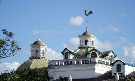
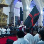
, Southern Ecuador | ©Angela Drake")
Driving on the Troncal Amazónica (E-45)
We found intermittent pavement again as we drove through villages on the lower slopes leading down towards the E-45. Each small town offered little in the way of services. Therefore, we found ourselves lunching on snack foods. Few cars use the highway so demand for services is few and far between.
We hit the E-45, the Troncal Amazónica that runs the length of the Amazon Basin from the border of Colombia near Lago Agrio (Nuevo Loja) to Zamora. The road gave way to gentle twists and bends with occasional straightaways lined with lush vegetation and the occasional small town. Our goal for the day was Yantzaza, a river town known for a small nature reserve and great birdwatching.
Our plan was to remain in Yantzaza for two nights. Unfortunately, the hotel we had booked had an unadvertised event that prevented them from offering us breakfast the next day. Far enough removed from town, it meant we would be driving back and forth for three meals. Enough of a reason to cut this part of the trip short. One night along the beautiful Río Yacuambi would have to be enough.


The next morning, on the way from Yantzaza, we passed more small towns worthy of further exploration. We were surprised to see many signs of Saraguro influence, something we did not expect to see in the Amazon Basin. However, statues and murals in several towns showed a definite blending of Sierran and Amazon cultures.
After arriving in Zamora to process our visa extension, we did head back along the E-45 to explore the area around Timbura.
Read more about applying for a tourist visa extension
The town of Timbura advertises what we though was a small birding reserve from the main highway. Unfortunately, the huge picture of a White-tipped Sicklebill hummingbird was a little misleading. However, we found something as interesting, a Shuar Cultural Center as well as signs leading to other interesting sights like waterfalls and hiking trails.


Zamora and the Road to Podocarpus National Park
Staying in Zamora for one night ended up being a good thing. This small town is full of great murals, a riverwalk-way to catch cool evening breezes, and a few restaurants and bars. Both Scott and I were able to photograph to our hearts content and get a good feel for the place. We loved the local market where we found excellent juice bars and pretty decent coffee. In addtion, we are sure that lunch would be excellent as well.
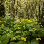
After our night in Zamora, we stayed three nights at the Copalinga Lodge, the first of five birding lodges on our route. Most of these lodges are run by the Jocotoco Foundation and helped define a large part of our trip. However, before checking in to the lodge, we drove out to the end of the road so that we could visit Podocarpus National Park. The drive itself is interesting as road parallels the gorgeous Rio Bombuscaro. We highly recommend stopping a few times to get out and take in the views.

Backtracking to Visit Cabañas Yankuam
From Copalinga, we had to back track a little to visit our next birding lodge, Cabañas Yankuam. This meant driving on the E-45 back towards Yantzaza. We turned off the highway in the small town of Zumbi. Using Maps.me to help us navigate through the convoluted one-way streets, we eventually found ourselves on the road to Las Orquideas, the tiny town closest to our destination.
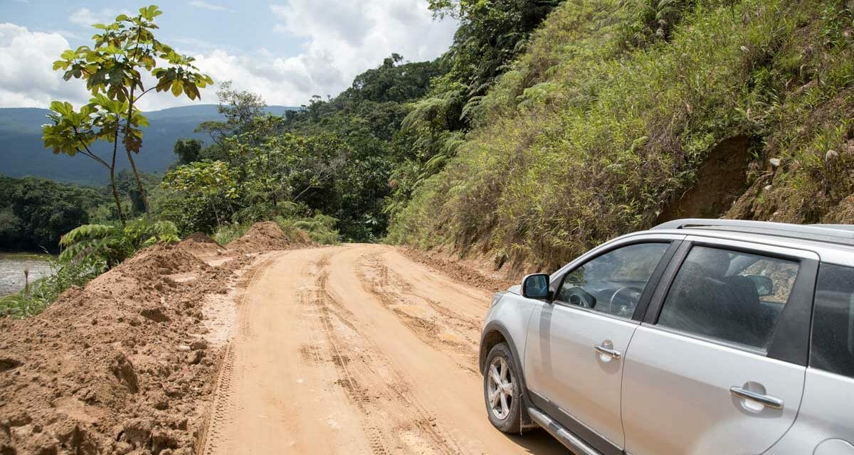
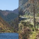
Located near the Peruvian border to the east of Ecuador, Cabañas Yankuam is about as remote a place you can be in Ecuador without arriving by boat or plane. It truly qualifies as off-the-beaten-path. In fact, most of the road is graded dirt – just take a look at the featured photo on this post. In the rainy season, the mud might get slippery enough to warrant a 4-wheel drive vehicle.
While Cabañas Yankuam was our overnight destination, we did drive as far as Miasi on our last day. From the road, it is very difficult to assess the damage being done to the environment. For that, you need to take a boat trip. From the river, it is possible to see multiple dredging operations reshaping the shores of the river as locals and foreigners alike strip the gravel beds of gold.


Leaving the Oriente for the Sierra
After our three nights at Cabañas Yankuam, we headed towards Loja, the capital of the province with the same name. This meant backtracking to Zamora. From Zamora, we would head inland on the E-50.
This steep highway can be dodgy in wet weather as waterfalls and cascades escape their natural courses to stream across the road. Rock falls and landslides also occur in rainy weather. Luckily, we experienced only light drizzle and low-lying clouds. As we rose higher and higher on the mountain, leaving the foothills far behind, the landscape turned to scrubby, dense cloud forests clinging tightly to high mountain walls.
From Loja we headed south to Vilcabamba on Highway 682. Vilcabamba and its neighbor, Malacatos, are in a small banana belt of the high Sierra, making crops like sugar cane and coffee easy to grow. From Vilcabamba, it is possible to see layer after layer of mountains. The weather is constantly changing, one minute there is a brilliant blue sky full of fluffy white clouds, the next there is a foggy mist approaching from the heights of the Podocarpus National Park. The combination often makes rainbows in the late afternoon sky.
This expat-haven was our stop for the night. While it might have been possible to make it to the next birding lodge, it was far enough away to play it safe.


From Vilcabamba to Palanda
Our next stop would be the Casa Simpson at the Jocotoco’s Tachipalaca Reserve, a high altitude cloud forest that protects a strange but surprisingly endearing bird called the Jocotoco Antpitta.
The road from Vilcabamba to Casa Simpson, Highway 684, is mainly paved with a few stretches of very bumpy, dirt road. The unimproved areas were usually well-signed with warnings of Falla Geologica. In this part of Ecuador, we passed through very few farms and even fewer towns as the road climbed through a dry, almost desert-like rocky terrain with the occasional hoodoo to shrouded high-altitude cloud forest.
Learn More about the Jocotoco’s Tapichalaca Reserve
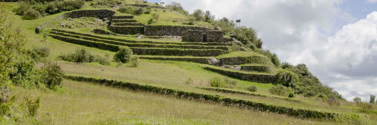
During day trips from Casa Simpson we drove through the closest town on the map, Valladolid, as far as Palanda, a large town about three hours from the Peruvian border. This time, it was an outdoor archeology museum that called to us, an ancient ceremonial site built by a little-studied culture.


Casa Simpson to the Dry Forests of Jorupe
From Casa Simpson, we headed to another Jocotoco property, the Urraca Lodge in the Jorupe Reserve. If we could have traveled as the crow flies, we could have crossed a mountain range for the most direct route. But roads in the region are not well-mapped nor reliable so we took the route recommended by the Jocotours staff. It meant driving back to Vilcabamba and Malacatos to catch a connecting road to highway 69. This intervalle is new and has yet to be added to Google Maps. However, it does exist on Maps.me though the app occasionally lost itself midway.
The new road is well-paved, if curvy. It passed through many farms growing sugar cane. We began to see Acacia trees and drier terrain the further west we drove. Occasionally, we would pass a zone of full blown spring-green grass and leaves, a sign rains had recently fallen. This road dropped us off just outside of Catamayo, the airport town closest to Loja.
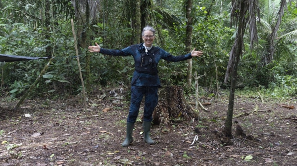
From Catamayo, we took the route to Gonzanamá-Cariamanga-Sozoranga. The changes along this route are practically miraculous. At first, we found ourselves driving through valleys full of farms with the mountains far in the distance. But as we moved closer to the peaks, we also moved higher in altitude until we found slopes covered in coffee plants. After that, we lost the mountain to extreme fog, some of the worst we have ever seen in our lives. The picture below shows the pass on the following day when we returned to visit the cloud forest at the Utuana Reserve.


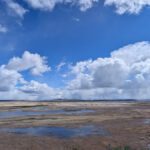
After dropping out of the fog, we entered yet another environment, the dry forests of Southern Ecuador. This region is extremely dry for most of the year. Yet it comes alive after a little rain, usually in December or January. Full of trees like Acacia, Ceibo, and Petrino, the terrain is similar to that of Mangahurco and Cazaderos where we observed the flowering of the Guayacanes only a couple of weeks prior.
After a long days drive, we arrived at the Urraca Lodge just outside of Macará, directly on the border with Peru.

From Macará to Piñas
Upon leaving the Urraca Lodge near Macará, our original plan was to visit the Puyango Petrified Forest. However, we decided that we would later backtrack in order to take advantage of the most time possible at next Jocotoco lodge on our list, Buenaventura. Everyone was telling us was the best in the south of Ecuador.
We headed out on the E-35 towards Catacocha. Unfortunately, we made a mistake. We put complete faith in our Maps.me app, failing to double check the route and ended up on a “short cut” that Maps.me recognized as a faster route. Not realizing the error, we drove this paved road for quite a ways. Then we saw a sign promising petroglyphs outside Alusaca that we decided we had to see. By the time we realized our mistake, kilometers into the secondary route, we felt the best option was to push ahead.


We crossed parts of Ecuador rarely visited by gringos. The road turned to dirt and wound through hilly, mountainous terrain. We drove through the small town of San Antonio, home to a large cock-fighting ring with few problems. But then, our two-wheel-drive vehicle, having neither the power nor the traction to make it easily up steep hills, questioned us at a couple of points. So did downed trees being removed by an ad-hoc work crew. Thanks to a good driver (my dear husband) and only damp roads rather than really wet ones, we did not have to turn back.
We came out just above the town of Olmedo onto the E-50. From there, we continued to the cross at Saracay where we took a right turn onto highway 585. We found the entrance to Buenaventura just up the road. Driving into this warm, humid cloud forest came as a relief after our harrowing day.

Buenaventura to Puyango
After spending three days exploring the area around Buenaventura, we had completed our route of the Jocotoco Lodges in southern Ecuador. We were ready to hit a few destinations in the south that are not normally included in birding itineraries. Next stop, the Puyango Petrified Forest.
We had to backtrack slightly on highway 585 to the cross with the E-50. But from there it was all new territory for us. We took the E-50 towards the E-25. Then we turned towards Arenillas, passing miles of banana plantations along the way. We also saw the tell-tale sign that we had arrived on the coast, the motorized tricycle!


A little further up the road, we arrived in the small town of La Victoria where we had reserved a hotel for the night. Little did we realize that the hotel had moved to Alamor, another hour down the road and past the entrance to the Petrified Forest. The note the owner had sent earlier that morning had told us they had moved to a new address. We made the incorrect assumption that he meant a new address in the same town. Just another small frustration of touring rural Ecuador!
We made it Alamor, a small town much higher than the Petrified Forest, where clouds roll in most evenings and encase everything in a thick layer of fog. As we walked around to take pictures in the mist, we wondered at the misleading Puyango sign in the center of town. We have yet to figure out where the real town of Puyango lies – in Alamor or just outside the Petrified Forest.

Puyango to Machala & Puerto Bolivar
After one night in Alamor, we headed to the Puyango Petrified Forest for the morning. It is only 5 kilometers of the main highway. We did not get lost.
In the afternoon, we drove to Machala, backtracking yet again! Through Arenillas, along the E-25 and many banana plantations later, we began to see the tell signs of the coast, shrimp farms. Also, the highway widens considerably and the road straightens out. No pesky foothills to wind around.
We hoped to check out possible trips to the newest addition to the national parks in Ecuador, Isla de los Muertos. We decided to stay in Puerto Bolivar to be close to the ports where we would ask about boat trips out the islands. That was another poor choice. Puerto Bolivar is not ready for tourism in any way shape or form. If you decide to adventure out to the islands, go ahead and stay in Machala. The extra distance extra is very little and you will be happier for the choice.

Machala to Zaruma
After our two sweltering nights in Puerto Bolivar, it was time to head back inland. Recently, the Ecuadorian Ministry of Tourism has been heavily promoting Zaruma, a mining-town with an ancient history and quaint downtown. Pictures of the town were encouraging so we decided to visit and see if the hype matched the reality. Once again, that meant backtracking on roads we had already traveled.
We drove right back by the entrance to Buenaventura! However, we also took the time to stop in the mid-sized town of Piñas to check out the newly-renovated orchid garden. Yes, if you like orchids, it will be worth your time!
Zaruma is only a short distance from Piñas. The highway twists and turns through Andean foothills, past gold mines, cattle pasture, and some low altitude cloud forests. The streets through town are narrow with many one-way roads heading up and down steep spots that put many of the hills in San Francisco to shame. In fact, it might have been easier to park the car in the municipal parking lot and walk to our hotel.


Zaruma to La Union
After a couple of nights in Zaruma, we continued on Highway 585 to a series of towns recommended for their own brands of tourism: Malvas, Arcapamba, Muluncay Grande, and Huertas. We were hoping to find artisan-made rum, trapiches making panela or other sweet treats, and a restaurant or two offering local dishes.
Although we found some interesting churches to photograph, as well as an airplane used during the Cenepa War by a retired colonel currently living in Malvas, we passed from town to town fairly quickly. The area was less heavily scarred by mining than nearby Zaruma though the bright red piles of dirt were a dead give away in more than a few places. Scarier yet were the illegal mines dug into the side of the road, a mere black hole without supports to protect miners during an earthquake or cave-in. This is not an area of Ecuador to go off exploring on your own.


We ended up in one of Dante’s circles of hell in the mid-sized town of Pacha. No matter which direction we seemed to turn, we always ended up back at the same point. There seemed to be no way to stay on the highway. Part of the problem was that every map app wanted us to through the center of town on a one-way road the wrong way. It was literally illegal to take it.
What seemed like hours later, but was likely more like 20 to 30 minutes, we took a road that looked to go nowhere. Miraculously, it put us on the correct route and we continued on our merry way!

Before coming to the end of highway 585, we encountered some familiar difficulties: landslides and fog. Fortunately, the landslide had mainly been cleared from the road though the viscous red mud had a way of oozing back onto the highway, forcing most of the traffic to share one and a half lanes at most.
Those heavy rains and cooler weather must have met up with the warm air from the coast. We ended up coming down a steep mountain pass socked in by fog, probably the second worst we had on this road trip. It made for a good excuse to get out of the car and admire the Virgen de Los Remedios.
We soon found ourselves among bananas again for a short while as we turned on to Highway 584 and passed by the mid-sized city of Pasaje, just outside of Machala. Yep, we had made it back to the coast only to almost immediately turn up a different road to head back inland. Travel in southern Ecuador is complicated by huge mountain ranges that must be driven around rather than over.


Our final stop of the day would be in the tiny town of La Union, entrance way to the Yunguilla Reserve, another property of the Jocotoco Foundation. Before arriving though, we would pass through some of the most stunning scenery we have seen in all of Ecuador, a region of arid mountains worthy of any we have seen in the Southwest of the United States. At first, we climbed through a rocky landscape marked by a large hydroelectric dam and a long tunnel through the mountain. When we came out through the other side, the mountains had been scraped aside leaving striped walls of mauve, aubergine, rusty reds, ochres, and pale cream of light sandstone. Each twist and turn revealed a new mountain and a new set of colors until we broke out above them all, looking over a landscape of bare, arid ridges seemingly empty of flora and fauna.
One day I hope to return and visit this place at dawn or at dusk to see how the golden hour light plays with the colors and shapes of this landscape.

Slowly, the barren landscape gave way to the occasional irrigated farm and then to more farms until finally we were back in what reminded us of the Ecuadorian Sierra, a landscape of cloud forests pock-marked with cow pastures. From Santa Isabel on, however, we saw more advertisements for hosterías and restaurants than in any other place we had been. It was easy to tell we were a mere two hours outside of Cuenca.
La Union to Cuenca
After our stay in La Union, we continued north on Highway 59. We turned off in Girón to take in the local sights. We enjoyed the central plaza, the modern church with its gorgeous stained glass windows, and the Museum de los Tratados. In fact, I would head back to Girón. It’s a quaint town which retains many traditions of the Sierra despite having many modern touches.
We also took a few minutes to stop further up the road at the Monument of Tarqui, a famous battle that determined the fate of the 1820’s war between Peru and Ecuador. While the interpretation is only open on Friday through Sunday, it is easy enough to enter and photograph the monument itself. Make sure to climb the steps and take in the view of the valley towards Girón.
With a stop for fritada in the town of Tarqui, we were just a few kilometers shy of our return to Cuenca and turning in our rental car.


In closing, I have to say that I am very glad we took this trip. I am even happier that we rented a car. The back and forth would have been draining on a bus and I can only imagine the cost, both in money and in stress, from hiring local taxis to take us from place to place. The few people we met along the way who had hired a local guide with access to their own car seemed the happiest and most stress free. In fact, it made we realize that we have to add a new question on our guide profiles: Do you have access to your own vehicle?
The most important lesson we learned along the way is to carefully plan a route that includes the places our clients really want to see, doesn’t send them on wild goose chases to destinations that don’t offer what’s promised, and attempts to never repeat a road. With our better understanding of the available routes in southern Ecuador, I have no doubt we can make that happen.


