First published on February 10, 2020 • Last updated on December 8, 2025
This page may contain affiliate links; if you purchase through them,
we may receive a small commission at no extra cost to you.
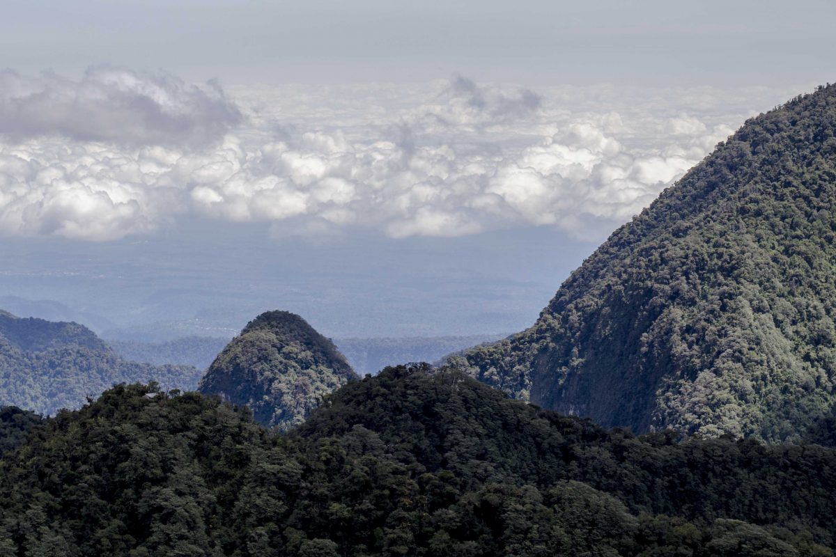
The Yanacocha Reserve protects a small slice of high altitude cloud forest about an hour outside of Quito. On a sunny day, it’s a great place to hike for unimpeded views of Guagua Pinchincha, the volcano that last erupted in 1999. The vista towards the coast is impressive as well. Nonetheless, rain or shine, the major draw is wildlife. Especially hummingbirds!
 is a show-stopper at the hummingbird garden in the Yanacocha Reserve | ©Angela Drake")
More About the Yanacocha Reserve
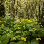
This small reserve is amazingly biodiverse. Even without a guide, it is easy to spot at least some of the 251 species of birds. Lucky visitors might also see an Andean Spectacled Bear or a more elusive Puma. All the while, visitors walk along trails full of flora, from huge leaves the size of elephant ears and diminutive orchids smaller than your finger nail. The stunning diversity keeps me coming back again and again.

The Endangered Black-breasted Puffleg Hummingbird
In fact, I have visited Yanacocha well over 30 times in the last few years, all in hopes of seeing one critically endangered hummingbird, the Black-breasted Puffleg Hummingbird. This tiny hummingbird is found only in three locations, Yanacocha, Zuroloma, and another reserve in the Imbabura Province. Sadly, loss of habitat is the prime reason for its status. De-forestation is occurring at an astonishing rate in many parts of Ecuador.

Despite my many visits to Yanacocha, I have never seen a Black-breasted Puffleg at this location. Yet our trips are always successful! We consistently add new species to our life list! We often explore different trails that traverse a new microclimate. Best of all, we always hike out to the hummingbird gardens to sit and enjoy the show. These colorful little birds never fail to amaze us, be it in heavy fog or bright sunshine!

What to Pack For Your Visit
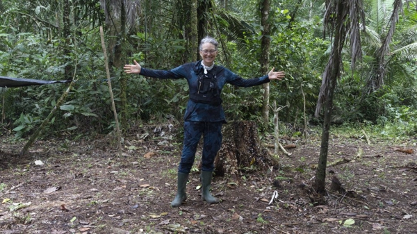
Weather can change rapidly on the slopes of Pichincha. Therefore, we recommend packing for rain no matter the conditions when you start your hike. We have a few other suggestions as well:
- Water – it’s easy to get dehydrated at high altitude. In fact, please read up on High Altitude Hiking before arriving!
- Hiking boots or other shoes/boots that are comfortable for walking but can also handle muddy trails.
- Sun hat – when the sun is shining, it’s strong; help protect yourself from the elements.
- Snack or lunch – you can hike for hours here so bring some energy food.
- Wet weather gear – rain and/or heavy fog can come at any time.
- Cold weather gear – a pair of gloves for those who get cold fingers and warm socks for those who get cold feet.
- Bug dope for the no-seeums. Seems season dependent but better safe than sorry.
- Flashlight – yes, there is a hiking trail that takes you through a tunnel; more below.
- Binoculars
- Camera with extra battery
- A photocopy of your passport (or your memorized passport number at the very least). You an use a cedula if you are an Ecuadorian resident.

Basic Directions to the Yanacocha Reserve
When we originally published this article in 2013, it was practically impossible to use Google Maps to find the Yanacocha Reserve. We would regularly get turned around in town trying to find the correct road up the slopes of Pichincha. So these written instruction were key… and we don’t want to take them down. Below, you will find a map with suggestions for using WAZE. But for those of you who benefit from reading the directions first, here you go:
A hop:
Find your way to Avenida Occidental aka Avenida Antonio José de Sucre or Avenida Mariscal Sucre (not to be confused with the neighborhood of the same name!). This is a major thoroughfare that runs north/south along the westside of Quito.
A skip:
Exit at Machala (running primarily to the East) and head up the mountain away from the city. This street can have many names – you might see Machala, you might also see Belen Historico or even Belen Suizo. About 500 meters up the road, bear left. If you’re lucky, you’ll see the signs heading towards Nono. Follow them! (You might want to add Nono to your adventure.)
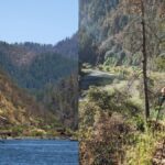
The good news is that this road is paved all the way to our turn off. You will wind your way up the mountain through pueblos, protected lands, farms, and more. You’ll also get some great views of the city but be warned, there are very few places to turn off and take photos. It’s just too dangerous. You might notice the turn off for San Jorge de Quito, another great place to explore the slopes of Pichincha. The distance from Avenida Occidental to our turnoff is 5 miles or approximately 8 kilometers.
A jump:
You’ll feel very far from Quito by this point even though it’s only 5 miles away. Just before our big jump, you will find a stoplight near a church. The stoplight supposedly turns green but we have seen plenty of people run it as it often stubbornly stays red for no apparent reason.
At this point, start looking for the Yanacocha Reserve sign! It will be on your lefthand-side next to a tall black metal gate, which should be open. This side road looks like it belongs to a farm with a house on one side and a pigsty on the other. It is a public road. Take it and start heading up the mountain.

A leap:
This is where you lose the pavement. The road becomes dirt with some gravel and/or broken down cobble. Recent rain can make it muddy in sections. On a dry day, this road is manageable without using 4-wheel drive. However, we do recommend using a high clearance vehicle. At the very least, drive very, very carefully.
From the turn-off to the Yanacocha Reserve it is another 5 miles (approximately 8 km). The vistas can be stunning in the early morning light! You will pass farms and spectacular views. You’ll drive through the Campamento Pichan where a guard might be standing at the entrance. He is protecting the water reservoir for the city of Quito. No worries, just drive on through unless he flags you to stop.
Finally, a little further up the mountain, you’ll see the last sign for the Yanacocha Reserve on your left and arrive at the parking lot!

A side note here:
If you plan on driving the Hummingbird Eco-route in the direction of Nono, you will have a choice when you leave the reserve. You can go back down the mountain the way you came. Or you can turn left upon leaving and drive through more countryside. The road will wind through the mountains and will eventually come out very close but just past Nono.

Entering the Yanachocha Reserve
Now that you’ve arrived, here is what you can expect. First, you’ll sign in at the little hut. Residents pay a nice low fee of $3 per Ecuadorian national and/or resident. Non-residents pay a grand $15 each. Yes the price difference is a big one. Please remember that the average Ecuadorian earns less than $1000 a month and that minimum wage is barely $400 a month. Your entry fee helps support the efforts of the Jocotoco Foundation, the organization protecting this unique habitat.
Your first stop before hiking should be along the short trail to the right. This leads to the fairly new visitor centers, cafe, and hummingbird garden. The visitor center has a small display, the cafe has snacks and drinks, and the hummingbird garden will have hummingbirds! We’ve had good luck seeing the Shining Sunbeam Hummingbird here though we have never spotted it along the trails.
Get Ready To Hike
The picture below is a little outdated but the trails it shows are not. Since this photo was taken, a wind storm blew over this sign. It has since been replaced with more up-to-date and easier to read maps!
Pro-tip: take a picture of the map with your phone before starting out. The reserve does not provide paper copies.
We have not hiked all of these trails though we have been on a great many of them. The descriptions below will help you decide which trails you might like to follow. Having a plan, especially if you will only visit once, is pretty important.

The Trail System at Yanacocha
The general rule of thumb is that the three trails leading to the right of green trail drop downhill. Therefore, you will have to climb back up at some point. They also all intersect. All of these side trails are muddier, narrower, and less open. It means that it can be harder to see birds. On the other hand, you might see birds and animals that shy away from the main trail.
Trails to the left of the green trail go up hill. Sometimes drastically. They eventually intersect with a dirt road (marked in yellow). The road drops back down the mountain and takes hikers to
While looking at this map, I want to point out that the green trail appears to go straight. It actually is the trail that goes through an old tunnel in the mountain. That will make sense when you see it. It will dead end in a landslide so cannot be used as a loop trail. More on that trail and more below!

The Inca Trocha Trail
We tend to stick to the Inca Trocha trail on our visits. This main trail is relatively flat. Therefore, we rarely feel the breathlessness that comes with high altitude hiking. It is also the connector trail – all other trails intersect with it. That means you can design several different routes.
The Inca Trocha path is the widest, the most level, and leads straight to the largest set of hummingbird feeders. In recent years, power lines have gone up along this trail. Though they are an eye-sore, they make a great perch for Masked Trogons. Listen for their sorrowful tones in the forest and keep your eyes peeled!

When you reach the largest grouping of sugar feeders, called Hummingbird Garden #1, there will be a split in the trail. You can go further out Inca Trocha through the small and very dark tunnel on the left. We unintentionally hiked out this trail thinking it was the loop trail on the map. IT IS NOT A LOOP TRAIL. It eventually dead-ends in a landslide. Maybe one day it will connect to the two Pichincha peaks: Rucu and Guagua. If you do choose to take the tunnel, I highly recommend bringing that small flashlight. It’s pretty dark in there.
Hummingbird Garden #1
The first hummingbird garden is my favorite place in the entire Yanacocha Reserve. I could spend hours photographing hummingbirds in this single spot. In fact, I have.
It would be near impossible to visit this spot and not see at least five or six different species of hummers. Their sharp peep, peep notes echo high among the tree tops. Even more thrilling is the fast beating of their wings, a thrum I can feel more than I can hear. That sound makes the nape of my neck tense and I always hope beyond hope that as I turn to look, I will catch a hummingbird in mid-flight.


Consistent visitors to these feeders include the Sapphire-vented Puffleg, the Golden-breasted Puffleg, the Buff-winged Starfrontlet, the Sword-billed Hummingbird, the Tyrian Metaltail, and the Great Sapphirewing, the second-largest hummingbird in Ecuador. Amazingly, these birds share the sugar feeders fairly uneventfully. Sure, they take a swipe at each other now and again but most seem to understand the rules of engagement.


The Upper Hummingbird Gardens
If this wasn’t enough, there is another hummingbird garden up around the corner. Keep walking along the trail just past the bathrooms on the left-hand side. After a short but steep hike, you’ll find a bench and a lookout point as well as an open-sugar feeder that attracts birds like the Masked Flowerpiercer, a bright blue bird with a striking black mask and startling orange eyes, and Glossy Flowerpiercer, a gorgeous black bird with a flash of Provencal blue on its wings.


This is also a great time to mention orchids as we have consistently seen some varieties in the trees in this location. For orchid lovers, there are many different varieties to observe along the entire trail. Keep your eyes open for tiny orchids hugging to trees, single stem orchids in the rocky mountain faces, and larger orchids hanging from high up in the forest canopy.


The Bosque Polylepis Trail
If you decide to hike on the trail past Hummingbird Garden #2, it eventually leads back to the main parking lot. Oddly enough, the only time I hiked it, I did not notice Polylepis trees. Truthfully, I hadn’t lived in Ecuador long enough to recognize them!
Be warned, the Bosque Polylepis Trail is very steep and the way back convoluted. It starts with long trek straight up the mountain for about 45 minutes to a dirt road, Camino a la Dispensa. To return to the parking lot, turn left turn on the road. A right turn is supposed to take you to the reservoir.


The Andean Snipe Trail
I have only hiked the Andean Snipe Trail from top to bottom. The views from the top are absolutely amazing. In fact, I didn’t realize how far we had actually climbed in altitude until I looked down and could see the main trail down below. It was so far in the distance that it shocked me. However, it was only on the way down that it hit home. While it was nice to take in the different flora and fauna at this altitude, it was really tough on my knees. The trail is not switchbacked at any point. It basically heads straight down the mountain at many points. I wish I had brought a hiking stick for this part of the trail!

This article was originally published in June 2014. It has since been updated to include more information about the reserve.
- Direction by Car, use WAZE and look for Nono, Pichincha, Ecuador. You will turn off well before reaching Nono.
- Direction by Public Transportation While you can take the bus to the turn off point on the main road, the hike up is considerable. We recommend hiring a local taxi or birding guide with car.
Information For Your Trip
Although this trip can be managed in a normal car, we recommend a high clearance vehicle. The last few kilometers are poorly graded and are generally in bad condition during and immediately after the rainy season. Expect lots of dust in the dry season. There is currently a small restaurant on site but please call ahead if you want to arrange for a meal. We recommend hiring a local guide with access to a car or driver.


Thanks for all the great information! Looking forward to planning a trip soon.
I am sure you will love it! Yanacocha is one of my favorite places near Quito. Rain or shine, it’s a beautiful place to visit.
It’s now three years later, and I have found your post while searching for, of course, Yanacocha information. Can one drive this route in mid-January in a regular car (read Airport rental, not 4WD)? Thank you for the insightful observations and lovely prose that brings the birds, plants and even the air, to life!
So sorry for the late reply! We have driven the route year round with no problems. Clearance is the biggest issue along one very bumpy, rocky portion of the road. Just go slow and look very carefully for large rocks that could hit your frame. If you are lucky, you might hit the road after it has been graded. They do that occasionally for the bigger vans that take in tourists.
Happy hiking!
Enjoyed your information about Yanacocha. I am wondering if there’s anyone going any time soon? I have been here 9 months, but haven’t gotten there yet. I leave the later part of May.
I go as often as I get a chance. Send me an email and maybe we can connect? angelajean4progress@gmail.com
Thanks for the directions! We’ve been searching online but couldn’t find anything until your blog showed up on my search results. We made it, however, it began raining with just a couple miles to go. We will have to try again soon.
Thanks again!
Sal
I’m so glad the directions worked! It’s tucked away in those hills!
We recently just took the road all the way to Nono and turned left and followed the route all the way to Tandayapa. Many opportunities to stop and look for birds, though all pretty much just on the side of a dirt road. We came back on the paved road to Quito. A few hours including a hike at the Orchid Reserve on the main road. We’re going to head out again soon and I’ll try to get it mapped somewhat so that we can share the experience with others!
What an awesome sight~
I can’t wait to go back!