First published on May 23, 2017 • Last updated on February 12, 2018
This page may contain affiliate links; if you purchase through them,
we may receive a small commission at no extra cost to you.
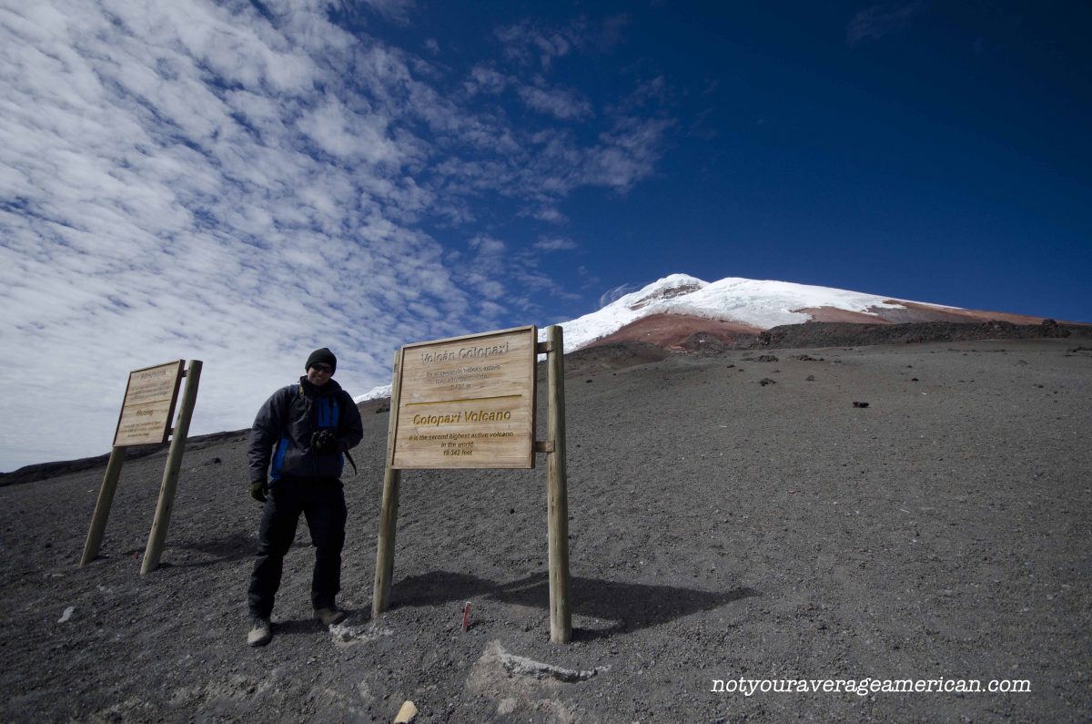
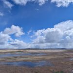
Today, the Refugio is a final destination. On clear days, it makes for a perfect spot to admire the other volcanos in the distance. On overcast days, the hike alone just might be worth it. The terrain is high paramo. There could be snow, ice, or just rocks and ancient volcanic ash.
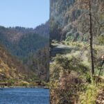
Your first step is to get to Cotopaxi National Park. It’s about an hour and fifteen minute drive from downtown Quito to the main park entrance, all signed from the highway. Once in the park, it’s about another hour to drive to the parking lot where the trailhead starts. And that’s without stopping much for photos! On a clear day, it’s hard not to take the time to just stop and enjoy the views. But if you’re hoping to beat the afternoon layer of clouds, which are unpredictable at best, then drive on!
Once you reach the parking lot, you’ll be rewarded with unbelievable views of both the mountains surrounding Cotopaxi and of the volcano itself. That is, if you arrived on a clear day.


Our first visit, we were welcomed by layer after layer of cloud. Or fog. It has become a long-running family debate on what to call the dense vapor that quickly envelopes the high mountains of the Andes. We could barely read the signs telling us we had arrived at our destination much less see a trail.
If you find weather like this, you might get lucky and hike up through the cloud layer. But be sure you know where you’re going. This is a mountain after all and it comes with a set of dangers that many people don’t seem to respect. We have watched hikers struggle with symptoms of high altitude sickness, like euphoria (acting drunk) and splitting headaches, their guides oblivious to the dangers of remaining on the mountain.
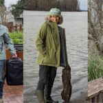
Most people who come to hike to the Refugio head to a trail that goes straight up the gut. It’s steep. It’s pea gravel and some ash, for the most part. The trail is part open tunnel, with tall sides and no rooftop, which you might think would protect you from the wind. At times, it actually serves as a funnel as the wind comes straight down the mountain and smack into your face as you hike up or pushes you forward at an ungainly pace as you hike down.
The Switch Back Trail
Our recommendation is to take a trail that starts on the far left of the parking lot and leads you through a set of switchbacks. The switchback route took us one hour and it allowed us excellent views of Antisana and the other mountain peaks to the north of Cotopaxi. The switchback trail is in much better shape than the well-used main trail and while it looks like it appears longer, it’s much easier on both the legs and the lungs. Take it!

A Few More Suggestions
We have a few other suggestions to help make sure you have a perfect day:
- Wear appropriate clothing including a warm hat, gloves, scarf, as well as the expected fleece and wind layers both top and bottom. You can manage without on some days but weather changes rapidly and temperatures can drop at an amazing rate. Better to be prepared.
- Wear hiking boots. You will see lots of people in tennis shoes. Going up is manageable but coming down is more complicated and the traction you get from a hiking boot or even good quality cross-country running shoe is essential to staying upright. We saw lots of people land on their butts on their way down. If you don’t have a choice of footwear, consider coming down the switchback trail which is much less steep.
- Bring plenty of water. You’re hiking at altitude and, especially in the summer, the winds will whip away the least amount of moisture. Add the equatorial sun and it’s a wicked combination. Proper hydration can help prevent the headaches that come from hiking at altitude. Also, wear sunscreen. Again, that equatorial sun is super strong.
- Bring calorie rich snacks to help with your energy levels. You don’t want a lot of food at altitude but you do want something to help you keep you moving forward. We prefer dried fruits, oil-rich nuts, and a little chocolate (local remedy for altitude sickness).
- Bring a basic first aid kit that includes your favorite headache medication. One of the first signs of altitude sickness is a headache. If you can keep it under control, keep hiking. But if it continues to get worse even with medication, please go back down the mountain. If you are hiking with a friend that exhibits signs of altitude sickness, such as upset stomach, light-headedness, constant stumbling, help them make the decision to turn around. Altitude sickness can make us less likely to make good decisions, not unlike drinking too much alcohol. And no view is worth ruining the rest of your trip, at best, or ending up in the hospital, at worst.
I hope you have as much luck as we did and find the most perfect weather day!
This post was originally published before the eruption of the Cotopaxi Volcano.
While the National Park was closed for a time, it is once again re-opened and it is possible to visit most of the park.
Hikes to Laguna Limpiopungo, the Refugio, and the Incan Pucara are permitted. The Glacier and the Summit are once again open. (updated February 24, 2020)
The Refugio
From the Main Entrance, follow the main road. Head right at the intersection that heads toward Tambopaxi and the North Entrance.
From the North Entrance, follow the road in and turn left at the crossroads.
Limpiopungo
The access road to Laguna Limpiopungo is just off the main road that runs through the park. If you enter using the North Entrance, turn right on the main road as if you are headed to the Main Entrance of the park, not towards the Refugio.
Pucara Salitre
The Pucara Salitre can be found using backroads accessible from the North entrance of Cotopaxi National Park.
Information For Your Trip
Prepare for cold weather, even on beautiful days. Snow and rain can occur at any moment. Carry plenty of water and high energy snacks. Be prepared to stop hiking if anyone in your party exhibits signs of high altitude sickness.
- Direction by Car, use WAZE and look for Refugio Cotopaxi, Latacunga Canton, Pichincha; for Limpiopungo, look for Laguna de Limpios, Pichincha, Ecuador.
- Direction by Public Transportation Unfortunately, there are no great public transportation options that make it possible to arrive, hike, and depart Cotopaxi on the same day. We recommend hiring a driver and car or staying the night at a nearby lodge. Camping is prohibited while the volcano active.


Great pictures and post! I’m climbing Cotopaxi and Chimborazo in January and any extra info and advice is always welcome. Thanks!
I’m quite jealous, actually. I don’t have the legs for either hike. It’s a quick turn around time to make the summit at Cotopaxi before you need to turn around and though I can hike forever, I hike slowly, especially at altitude.
You, however, are in for the trip of a lifetime! I assume you’re training for both. Friends that have attempted and failed told me that they underestimated the strain on their legs. Once you hit glacier ice, it sounds like there are no opportunities to rest your legs. Even breaks are spent standing. They wished they would have better prepared for that part of it. If they had, they might have made the summit.
You should also get to see the Refugio open for business. Rumors have it that it might be finished 🙂