
First published on February 18, 2016 • Last updated on May 12, 2016
This page may contain affiliate links; if you purchase through them,
we may receive a small commission at no extra cost to you.
Most visitors to the Galapagos don’t even think of hiking up to a crater rim of an active volcano. After all, the Galapagos is supposed to be about animals and there are few of those to see in the stark landscape of hardened lava flow. But ever since I heard that the Volcán Sierra Negra is the second largest caldera in the world (supposedly outsized by the Yosemite Super-Caldera), I was bound and determined to see its entire 60 square kilometers (37 square miles) laid out before me.
Volcán Sierra Negra is a shield volcano located on the Isla Isabela. Shield volcanoes are circular and have a gentle slope and low profile. Its shape is often obscured by low lying cloud and that prevents many a tourist from asking about visiting because many don’t even realize that it is there.
Don’t be fooled. Although the volcano is often cloud covered and receives large amounts of rainfall and the trails can be muddy, it is often clear at the crater rim, a fact that isn’t always apparent from Puerto Villamil.

 We were fortunate that the day we hiked this trail had followed two rain-free days. We did not need to rent the recommended rain boots and tackled the trail in sturdy hiking boots instead. A few spots were muddy but we were able to work our away around them without danger of slipping and falling in the mud.
No matter the weather, hiking in water-resistant boots with good treads is a must! Do not tackle the uphill portions in tennis shoes or sandals, even in the best of weather. If you rent the rain boots, consider carrying hiking boots or trail shoes with you, especially if you plan on taking the trail on to Volcán Chico. That path is hot, dry, and dusty and your feet will sweat to death in rubber boots.
 The uphill portion of the trail winds through a forest of guayaba, a non-native, invasive species of fruiting tree. The protection of the low lying trees provides great habitat for birds, especially finches. But hiking with a group can make it tough to take pictures of wildlife. If you are a birder wanting to take your time up the trail, make sure you ask your travel planner for a day trip that allows you to hike at your own pace. Alternatively, you could hire a private taxi to drop you off and come back to pick you up for the return. An early morning start would be best both for the birds and to have the trail to yourself.
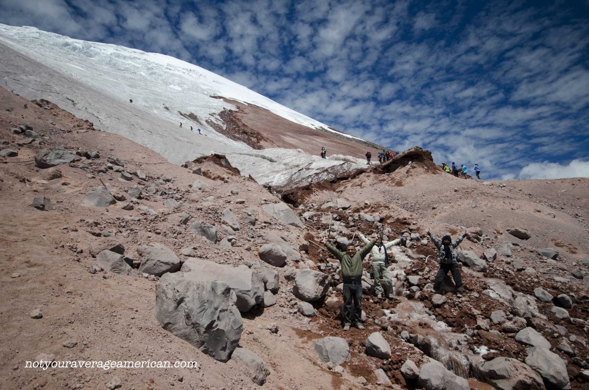
Once at the crater rim, about an hour’s worth of hiking, we were rewarded with a marvelous view of the interior of the caldera. It is an incredible sight, a vast open area of multi-colored, crusted lava and encroaching green vegetation on the very edges of the crater rim.
And mid-morning seems a good time to show up. We arrived just as the morning fog was fading. Misty clouds made patterned shadows over both the dark blue-black and rusty red lava formations. The distant crater rim played hide and seek for a while. It made it all the more stunning when we were finally able to see the entire 30 kilometer (18.5 mile) perimeter.


 Volcán Sierra Negra is also active and we observed vapor evaporating from the crusty lava formations in the caldera below. Looking north, over the top of the caldera from the view point, you will notice the remains of the 2005 eruption. Lava spilled over the crater rim, away from populated areas, but towards the next part of the hike, Volcán Chico.

After spending a few minutes admiring the view, we headed on the trail that continues around the crater rim. It is possible to make two choices after hiking partially around. You can take a wide, open trail back to the start or you can continue on to Volcán Chico. Be warned that the hike out to this spectacular location is twice what you have already hiked and will make the total trip 5-6 hours long.
For a description of the Volcán Chico portion of the hike, check out our this post.


