First published on December 11, 2015 • Last updated on May 8, 2017
This page may contain affiliate links; if you purchase through them,
we may receive a small commission at no extra cost to you.
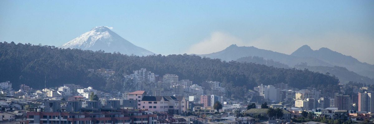
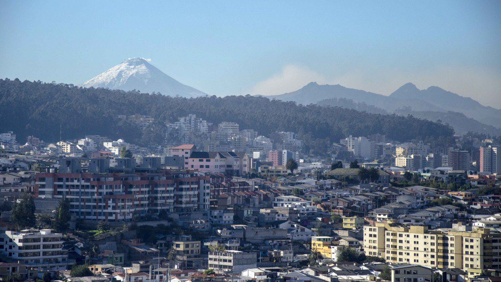
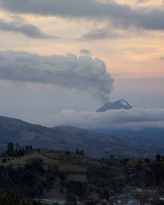
It has been months since Cotopaxi first started to emit ash and vapor, when it gently rumbled and sent minor earthquakes trembling across the land, and many of us panicked, certain that the volcano was due to erupt immediately. When calmer heads prevailed, there was still major concern and for good reason. And, although, a few things have changed these last few months, caution is still the word of the day.
 We are no longer on orange alert. The Ecuadorian Government let the final day of the State of Emergency pass without renewing it – families have returned to their homes and farms. Life is taking on a new normal.
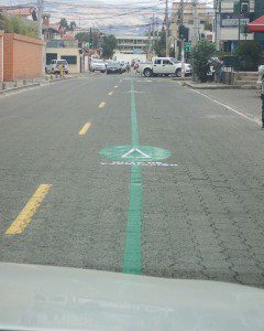
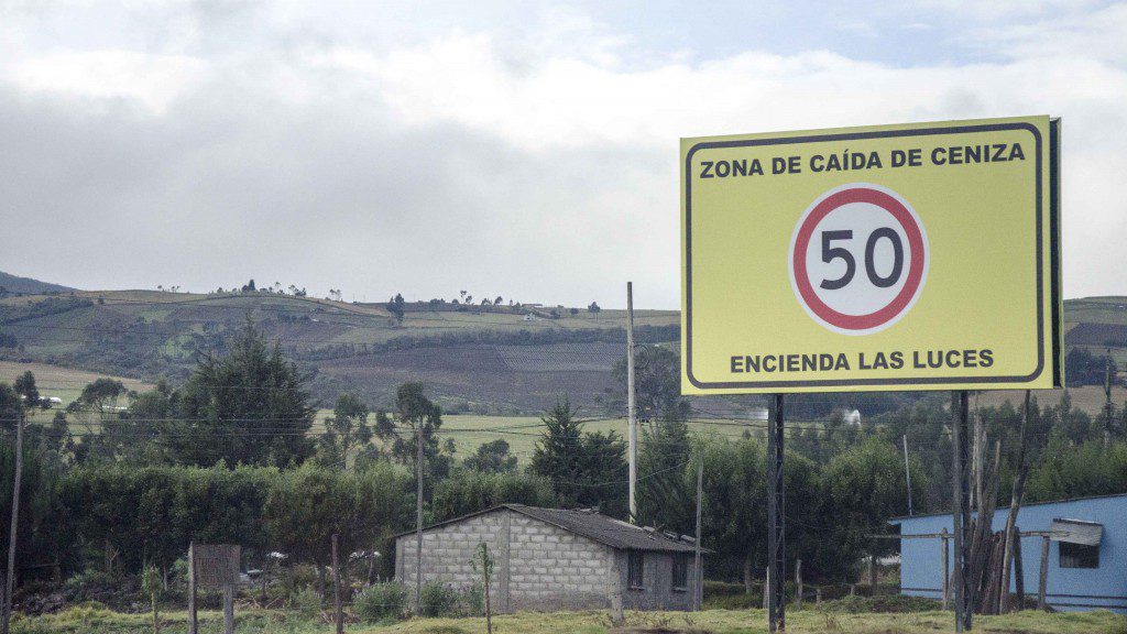
For some places, the new normal includes emergency evacuation routes marked on roads, signs warning of potential ash fall, and constant conversation about emergency evacuation plans. When Cotopaxi first awoke, few schools or hospitals had action plans. Today, the vast majority know exactly how they will leave areas that may be inundated by dangerous lahar, a combination of melting ice and volcanic debris that travels tens of meters per second.
Places like La Hacienda Los Mortiños, which lie near the path of potential lahar flow, are once again open for business. Owner Pablo Fernández says that they have been welcoming tourists since the lifting of the emergency and people have been “hiking, biking, and horseback riding, in secure and safe zones near the Volcano Cotopaxi.” They have worked with local government organizations to develop a contingency plan and taken part in emergency simulations to be prepared in the event of an evacuation.
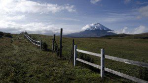
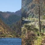
In fact, tourism is about to increase once again as the Ecuadorian government has decided to re-open the National Park. Although Fernández was advised that the magic day will be Monday, December 14th, news organizations are reporting that gates are opening today, Friday, Decmeber 11th. It is still unclear which roads and paths will be made available to tourists. No one is yet sure if Hiking to the refugio will not be permitted. It is possible that only the trails at the base of the volcano, like the one at the wetlands at Limpiopung will be opened. Nevertheless, the re-opening of the park signals a new era in tourism and in volcano watching.
@navasveracesar con zona n x un XT x-/ /
— María Belén Sánchez (@belensanchezand) December 9, 2015
Preparando reapertura del parque Cotopaxi. Buen trabajo @Riesgos_Ec @Ambiente_Ec @TurismoEc @MTOP_Ec @Seguridad_Ec pic.twitter.com/4nuU4kWQRQ
— César Navas (@navasveracesar) December 9, 2015
And it isn’t just the National Park that will feel a return of tourism – beautiful hiking spots along the Rio Pita, like the Cascada Condor Machay or the Cascada Rumibosque can be added to your bucket list once again. We hope that small restaurants in the zone of Selva Alegre, like our favorite place to eat grilled cuy, will find a new normal as well.
For those of you chomping at the bit to return to Cotopaxi National Park (yes, that includes myself!) or other destinations that could be impacted by a potential eruption, a few advisements are in order:
- Carry an emergency kit with you… although it is most likely that the volcano will send firm signals of an eruption beforehand, volcanos are unpredictable. It is best to carry a mask, plenty of bottled water, and some food, just in case you end up stuck during an emergency evacuation.
- If you travel with a tour company, please ask them what their plan is if the volcano erupts. If you’re told that there is nothing to worry about or that they will deal with issues as they happen, look for another company. Having a plan of action is an important sign that the company takes the volcano seriously.
- If you stay overnight in a zone that could potentially be hit by lahar or be cut off by lahar, ask about the hotel’s emergency evacuation plan. If you are unsure if a hostería, hostel, or hotel could be affected by an eruption, please check out the map provided by the Secretaría de Gestión Riesgos. Lahar zones are shown in bright orange-yellow and are more easily seen when you double click on the area of concern. (In the drop down menu choices on this page, you will want: Tipo – Volcan:Cotopaxi-Lahares; Provincia and Canton menus not working as of publication.)
- All tourists should follow a good source for information. Those of you on Twitter might want to follow #VolcanCotopaxi or @Seguridad_Ecuador. Those of you on Facebook might want to like Ministerio Coordinador Seguridad Ecuador. And the American Embassy suggests that all tourists register with the Smart Traveler Enrollment Program or STEP before your trip – this will allow the Embassy to contact you in the case on an emergency, natural disaster, civil unrest, etc.
 And these precautions hold true for other locations in Ecuador – for example, the Volcano Tungurahua is at Orange Alert. It is located near the popular tourist destination Baños del Agua Santa. For an up-to-date report on which volcanoes are on alert and which are in active eruption (though may have a low alert level), check out this page.
Not Your Average American highly recommends that you come #ExploreEcuador! Just come prepared for the new normal.


