First published on November 26, 2022 • Last updated on August 1, 2023
This page may contain affiliate links; if you purchase through them,
we may receive a small commission at no extra cost to you.
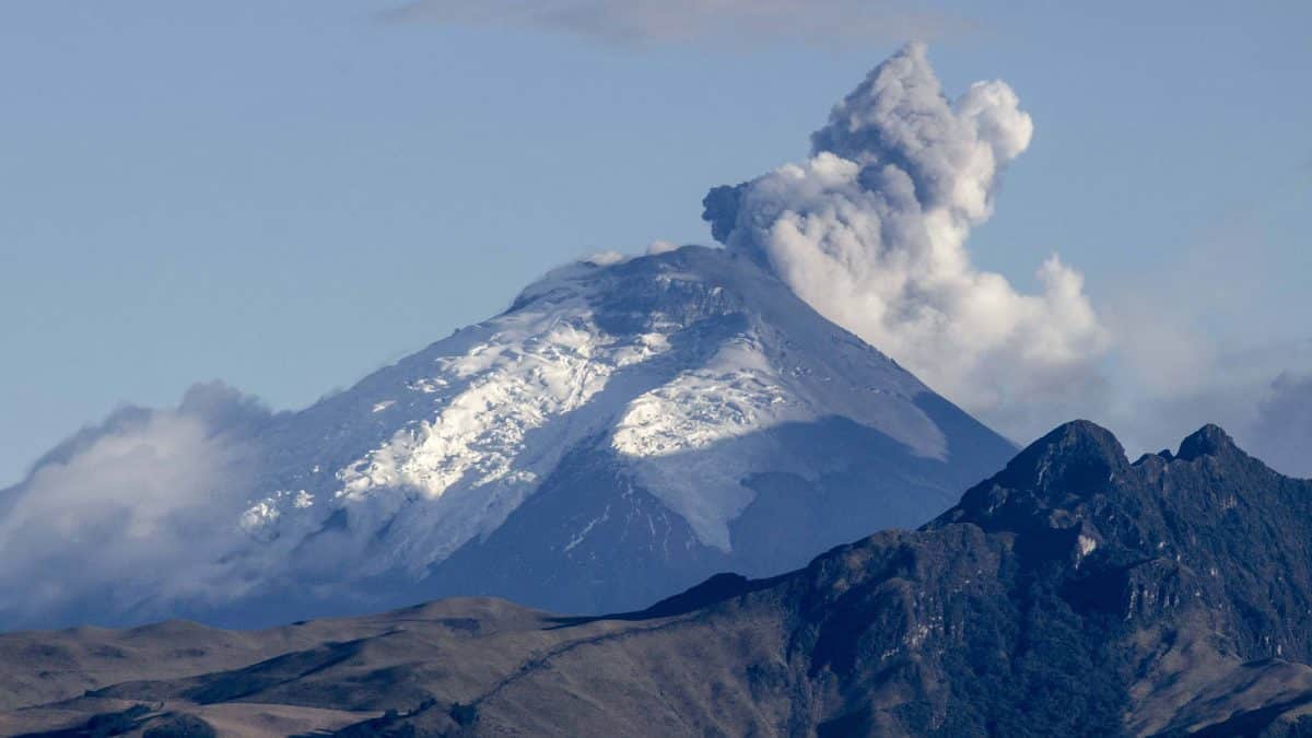
Since Cotopaxi is once again threatening to erupt, we are updating this article, which we originally published in 2015.
When Cotopaxi spewed mild amounts of lahar and spat ash clouds into the sky in 2015, the government began evacuating folks and it caused panic. Living in Quito under the auspices of the US Embassy, we were told to stop traveling to locations that could be cut off by an eruption. Basically, this current eruption was met with outright panic because there were no plans for local communities to survive an eruption.
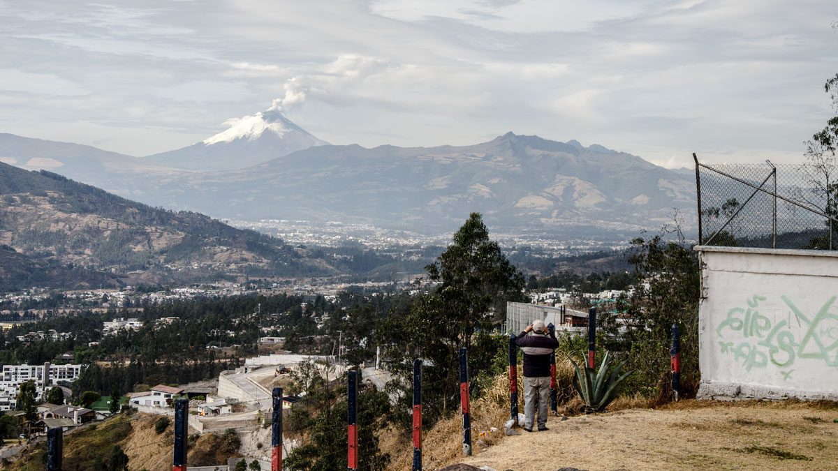
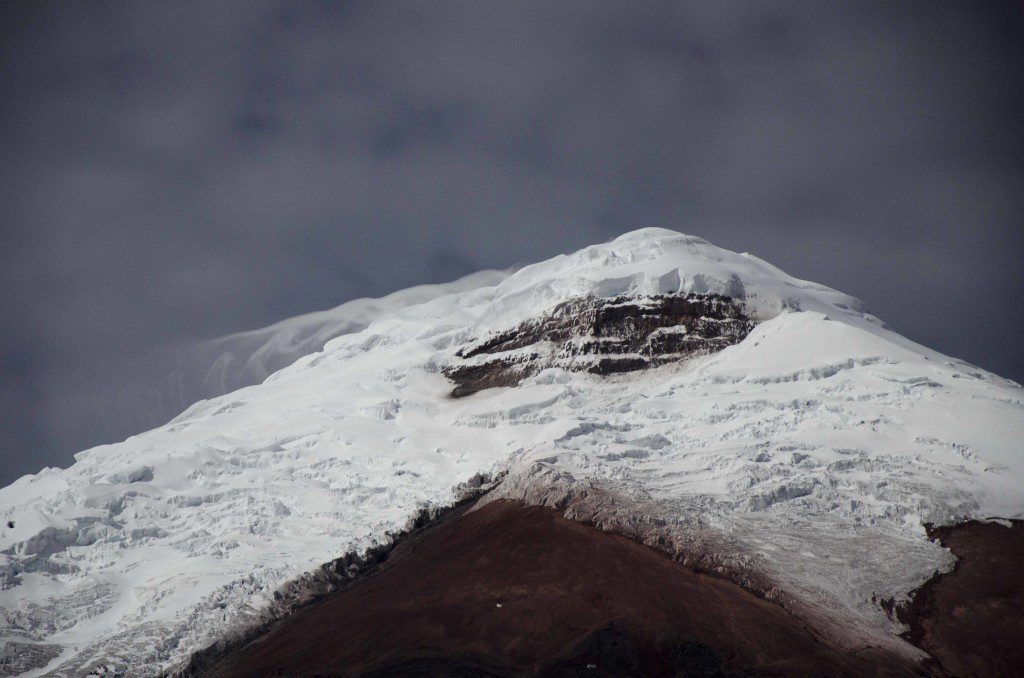
Cotopaxi With Ash & Vapor Plume | September 2015 | ©Angela Drake
Today, the situation is different. With plans for evacuation in place and having experienced this threatening behavior in recent years, many people feel indifferent. Others still feel panic and insecurity.
Caution but not panic…
After listening to the November 26th, 2022 episode of Esto Sí Es Ecuador, it is clear that our response needs to be more measured. On the show, Theo Toulkeridis, a geologist and vulcanologist with years of experience monitoring and studying Ecuadorian volcanoes shared his concerns. And they were aimed more at the government response than at the volcano itself. He believes it is important to be aware of the risks but not to panic, that there are tools to measure warning signs that will precipitate a large eruption. So, for example, while the Ecuadorian government closes Cotopaxi National Park, he believes it is not necessary at this point in time.
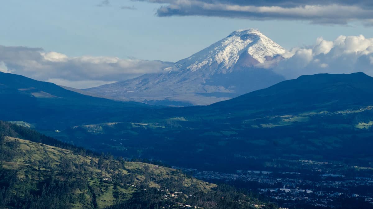
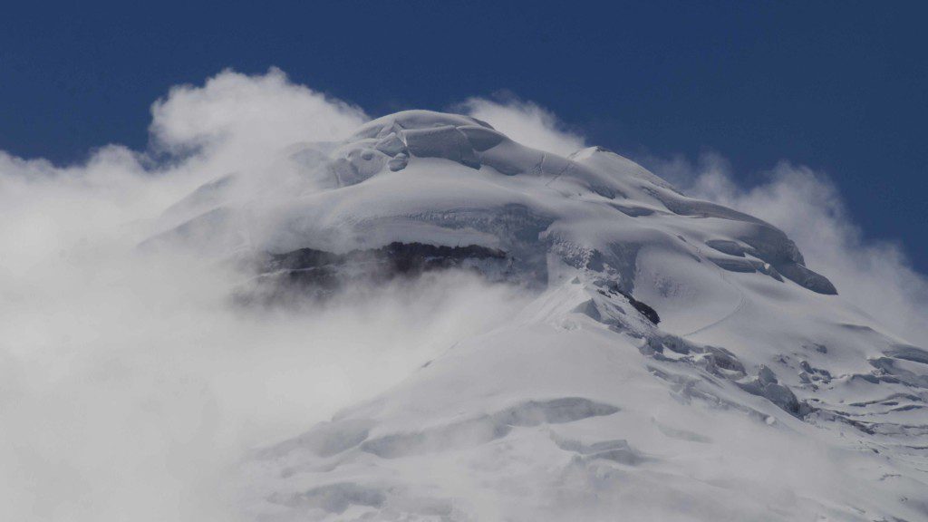
Cotopaxi from North Quito | April 2016 | ©Angela Drake
If it sounds like a balancing act, it is.
This blog post should help clarify the current situation in 2022. As a reminder, when we lived in Quito, the news outlets in the United States and abroad made it seem that everyone living around Quito was in harm’s way. We were not. Nor are tourists who decide to visit today.
For local Ecuadorian friends living in areas that will likely face evacuation if volcanic activity increases, it is worth having the conversation about how careful we need to be when traveling along the Valley of the Volcanoes.
Let me repeat this guidance for our readers:
Currently, tourists can safely visit Quito, the Valley of Volcanoes, and the areas around Cotopaxi National Park.
Please be prepared for an eruption or ask your guide and travel company what preparations they have in place if the volcano should erupt in a major way. If ash is heavy, consider visiting other destinations. This is a time to be patient and be willing to adapt. We highly recommend working with a local guide for the best advice and preparation.
In order to be better prepared, we also recommend learning as much as possible about Cotopaxi’s history and the worst side-effects of an active volcano.
First, a quick history of the Cotopaxi Volcano
 Cotopaxi is a stratovolcano which means it is in the shape of a cone and is built up of many layers of old volcanic activity, including lava, ash, pumice, and mud. When these kind of volcanos erupt, the result is usually explosive.
In the last couple of hundred years, Cotopaxi has erupted more than 50 times with the most violent eruptions destroying the nearby town of Latacunga. Today, Latacunga is a bustling metropolis surrounded by hundreds, if not thousands, of small farms that provide much of the economic base to the area.
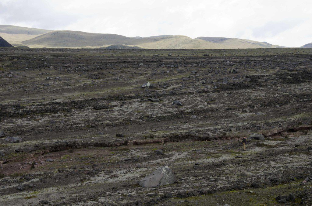
In 1877, the eruption from this volcano produced lahar flows that travelled more than 100km into the Pacific Ocean to the west and into the Amazon Basin to the east. Lahar is a deadly combination of volcanic ash and debris that mixes with water, often the melted snow and ice from the mountain itself, and moves at a rapid pace. In fact, it makes it difficult to evacuate populated areas once the process starts. Lahars are like rivers and are likely to follow existing riverbeds, both those that are dry and those that are full of the water. And therein lies the problem.
Second, the educated guess.
The government of Ecuador has been preparing for such an event for a long time but that doesn’t make the execution of an emergency plan an easy thing. There is constant debate in times like these about when to call for evacuation and when to wait. After all, volcanos do not keep an appointment schedule – they can threaten eruption and then decide to calm down without scientists ever really understanding why.
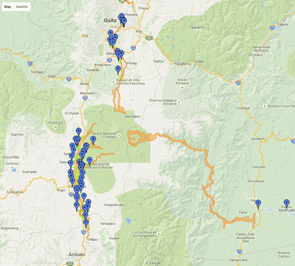
In 2015, the local government called for some evacuation in areas most likely to be affected. They used this map to explain why:
UPDATE – this map is no longer online. But this screen shot helps explain which areas will be in eventual risk from lahar flow.
All of the wide orange lines are possible lahar flows from Cotopaxi; the blue markers are safe zones; neon green lines are evacuation routes. Please be aware that although lahar is likely to follow these paths, extreme lahar can overcome natural boundaries and flow in directions that were not expected. Anyone living in low lying areas should have an evacuation plan.
Notice that there are many blue markers along the corridor just north of Ambato running up towards Machachi. This is where Latacunga lies, the place that has been decimated by this volcano before, placing it at higher risk than other locations. It is also an area of high population. If you are in this area, especially as a tourist, it would be a good idea to ask about evacuation plans. Lahar could possibly cut transportation routes and complicate evacuation once the volcano erupts.
 The same concerns exist for population areas just south of Quito, particularly in Sangolqui. This hits pretty hard as I have many friends that live in the area. Furthermore, the backroads from Sangolqui into Cotopaxi National Park are some of my favorite stomping grounds, with mountain valleys planted with wheat and quinoa, rich pasture land full of cows, sheep, and horses, secret ravines teeming with orchids and hummingbirds and, my favorite, the waterfalls that tumble from the high slopes of Cotopaxi as the Rio Pita makes its way to the valley below (Rumibosque and Condor Machay). The environmental impact could be potentially devastating.
And as deadly as the lahar might be for so many people, those living in Quito itself will be safe. There is no way lahar will travel uphill into the capitol city itself.
Third, ash.
Those communities that do not need to worry about lahar will need to worry about volcanic ash. In 2015, we experienced slight dustings in North Quito with heavy ash in parts of the south.
The best resource I have found on how to deal with volcanic ash can be found at the US Geological Survey webpage. They have several lists for home, business, and communities on how to lessen the impact of ash in your home and how to clean up ash after the fact. While much of the advice just sounds like common sense, many of the items came as a surprise. For example, did you know that wearing contact lenses during an ash fall could damage your eyes? Please, if you live or will be traveling in the area, take the time to read the precautions. Travel with a mask – not a hard thing to do since the pandemic started – in case you encounter ash in your travels.
Fourth, water
If Cotopaxi erupts in a spectacular manner, it is likely to affect the local water supply. Please have plenty of water on hand as you may not have water from your tap nor will the local water delivery service be able to make their scheduled trips. In 2022, we actually filled one of our bathtubs with water to be better prepared. We soon learned that this was not the best plan at the time. Since we have so much warning, people living and staying in and around Quito for any length of time should have extra water. Ask your hosts if they have already stockpiled theirs.
You may end up in a situation where you will need to drink the local tap water. Remember, you can sterilize it by boiling for a minimum of 3 minutes, by using chlorine tablets, or with a small amount of bleach (6 drops of bleach per 1 gallon of water). For exact instruction on how to make water safe to drink, visit the EPA website.
Finally, a little advice
When we originally wrote this article, we asked residents of Quito to be calm and be patient knowing that it could take years for the a true eruption. That is still the case. This volcano could potentially threaten large eruptions for YEARS on end.
If so, the wait will be frustrating as we hear that the volcano is about to blow and then we hear that things are calming down. Find a good source for information that you trust and don’t panic. Those of you on Twitter might want to follow #VolcanCotopaxi or @Seguridad_Ecuador though the former is sometimes used by news sources using clickbait headlines.
For our friends and family reading this article, if you want to help with future disaster relief efforts, check out the International Red Cross. They are already on the ground and have been helped put plans for eventual evacuation. Even today, they are more than ready to go into action.
If you hear that an eruption has happened, don’t panic, especially if your are visiting Ecuador. If you are working with one of our recommended providers, they are prepared to help you! If you have purchased travel insurance, it should include help leaving in a true emergency like a volcanic eruption. If you haven’t, let us know anyway. We will do our best to connect you to people on the ground who can help you out.
In the meantime, enjoy your trip to Ecuador! You won’t regret it!







Hi Angela, I enjoyed reading this article, thank you. I was hoping you could give me some suggestions. I’d like to get some shots of Cotopaxi this weekend but only have a little scooter to get around. Are there any easy spots to reach with good views of the volcano? I love the back way through Sangolqui, but my scooter can’t make it on that road (if it’s even open) and I’m sure that would be too dangerous. Thank you!
Not sure where you live in Quito but someone took excellent photos from a location up on the slopes of Pichincha and I think they were at the monument to the Battle of Pichincha, La Cima de la Libertad (https://notyouraverageamerican.com/2014/05/29/in-memory-of-the-battle-of-pichincha/). You might also try the Hospital Metropolitano at the top of Mariana de Jesus. You can see Cotopaxi very well from their outdoor patio in between Torres 1 and 2, just outside the Fybecca. Another tip – if you know anyone living in a tall building downtown, ask the building manager if you can access the roof for photos. I wouldn’t bother with the Panecillo as the view was only fair. Good luck and be sure to share your photos with us! (https://www.facebook.com/NotYourAverageAmerican)
Thank you for the suggestions! And I’ll definitely share any good shots I get. I was also thinking of getting to Sangolqui, there should be some good shots from around there, right?
There are some places with views… haven’t marked any as return to points for definite photos but would love to hear of any good spots you find. Make sure you know your evacuation routes before you go 🙂
Thank you Angela for the info. Been checking the map on Safari and it works fine. I live close to ESPE in a sort of “island” between Pita and Santa Clara rivers, about 38 km away from the volcano. I understand lahars travel about 1 kilometer per minute and in this case math is simple: 38 km = 38 minutes, about a block every 5 seconds. I was hoping the government with its many radio stations would destine at least ONE for 24/7 information and warnings and I’ve left comments and emails all around the web to no avail. In a serious emergency, forget about TV, internet, conventional phones and even cell phones after a while, batteries DO run out. The lifes of 325.000 people are at stake and all I see in Ministerio Coordinador Seguridad Ecuador are some lovely and bucolic pictures of the volcano. I was living in Colombia 30 years ago when Volcán Nevado del Ruiz erupted provoking lahars in 4 different directions, one of which reached Armero through Río Lagunilla in the middle of the night. A town the size of Machachi was literally wiped out, no radio, no sirens, no nothing for 23.000 souls. That’s hard to forget. All serious information and educated guesses are welcome here.
I will add Safari to the list of good browsers. Thanks for letting us know.
Many people are asking for 24 hour info so you are not alone. Your location is of the utmost concern… is your local government at all involved in making sure you guys at least get that 30 minute warning?
Please be safe!
WARNING? Quito’s mayor thought of sirens last week and said it would take about a month to get them here. I would think Rumiñahui´s authorities are doing likewise, just hope they make it snappy and choose a tone radically different from the ones police, firemen, ambulances, car and home alarms,etc, have. You can’t imagine how nerve wrecking it is to hear one in the middle of the night and try to guess the origin or the cause for it.Thanks anyway for the wishful thinking Angela. There have been some information centers and evacuation drills put up over the weekend but I can’t help but wonder what will happen next Monday when schools start and have 28 of them in red areas in Sangolquí alone. ESPE (military university) nearby too. I’m surrounded !!! But nothing to worry, I have 88.9 FM (Ecos de Rumiñahui) on my car and home radios, they tell me its the “official” station down here. Remains to be seen, or heard in this case. So far a good Gloria Estefan special yesterday afternoon. LET IT BE
Although I don’t live in Sangolqui, I do volunteer once a week in the area. I’ve been looking closely at the map to figure out evacuation routes from the neighborhood I visit and there really aren’t any. I understand your concerns. While I was videoing the volcano up above Conocoto there was a man with a satellite radio reporting activity. I asked him what he was doing and he said that he was basically a part of a neighborhood watch and he was reporting activity to the local authorities. That is a positive sign, albeit a small one. It sounds like you have a good understanding of what needs to happen… I hope there are ways for you to contribute your ideas to the local authorities so that you can help rather than just worry. I know that isn’t generally the way things are done here but emergencies can often push the envelope for positive change.
Thanks again for the updates Angela, wish I could get in touch with “the Conocoto man”, he sure has a better view. Dropping by ESPE tomorrow, they are serious people.
If you’re serious about meeting the guy from Conocoto, I recommend heading up to the highway on Simon Bolivar – the rest stop at the gas stations that overlooks Cotopaxi and the surrounding valley was where I met him – late afternoon, early evening, middle of the week. He was carrying a satellite radio. Clear day attracts lots of folks to that spot and I bet he would show up again.
A source tells me that there is also a meeting next week to discuss how to evacuate one of the nursing homes in the area. It isn’t far from where you live and there is concern that there are not enough exit routes that don’t pass lahar zones. You aren’t the only one talking about all of this!
Keep up updated! And I’ll do my best to do the same.
Mari a la distancia recibir esta información es muy gratificante , gracias por haberlo hecho abrazos
Me alegro que la información les ha ayudado!
Thank-you for this informative blog post. The link to view the map on the SGR website doesn’t appear to be working. I even tried clicking on the link in their banner and it didn’t work either.
It looks as if they have been modifying the map. Perhaps when you tried, they were making some of the additions. They have added locations of hospitals, schools, etc. and have made it possible to add and remove features from the map itself. I do know that the site cannot handle a lot of traffic at the same time, so looking at it during off times, like when the volcano is at its quietest or while Ecuador is fast asleep, is probably a good idea. Thanks for letting me know the problem!
Todd, just learned today that the SGR website does not work with Internet Explorer. It is best seen using Google Chrome or Firefox. Hope this helps.
Thank you so much for this well written piece. My family is in Conocoto- they tell me that it is scary and have already started to store clean water and gather supplies. This helped explain a lot since I have not yet been able to actually speak with them. Thank you!
I can understand their concern. The government is trying its best to maintain calm and evacuate only those areas in immediate danger. Conocoto will have some warning as it isn’t directly on the slopes of the Cotopaxi. The warning combined with your family’s preparations means that they should be just fine.